On Vancouver Island, waterfalls do not perform on a schedule. But they respond to rain, gravity, and seasonality. In summer, many of them retreat into the forest — narrowing into quiet threads slipping over stone, easy to miss unless you know exactly where to look. By contrast, when winter arrives, bringing Pacific storms and weeks of steady rainfall, the Island’s hidden water systems awaken. Creeks swell, underground channels overflow, and the rocks burst into a roar. This is when waterfalls become what they were meant to be. And that is why winter is the best season for waterfall watching on Vancouver Island. Winter makes it clear that the Island is not a static backdrop, but a living system.
Waterfalls Created by the Climate
Vancouver Island sits within a maritime climate zone dominated by westerly winds from the Pacific Ocean. In winter, moisture-laden air masses rise as they encounter the Island’s topography, cooling and releasing precipitation — a process known as orographic lift. The result is long-term rainfall rather than short-term storms. And it is this constant influx of winter rain that is the key to the existence of most Island waterfalls.
In the Capital Regional District, this means that creeks classified as “seasonal” in summer become fully connected hydrological systems in winter. The result is not just more water, but greater complexity — wider falls, shifting channels, mist that hangs in the air, and sound that carries through the forest long before the water comes into view.
Top 10 Waterfalls to Visit in the Core of Greater Victoria Winter
Today, we’re setting aside the well-known scenic icons on Juan de Fuca Marine Trail (like Mystic Beach and Sombrio Beach waterfalls) to focus on gems in the core of the Capital, all within a 30-minute drive of Victoria. Their short hikes are accessible year-round, but winter offers the most rewarding experience — with fuller flows and richer colors, and unrestricted access to every location.
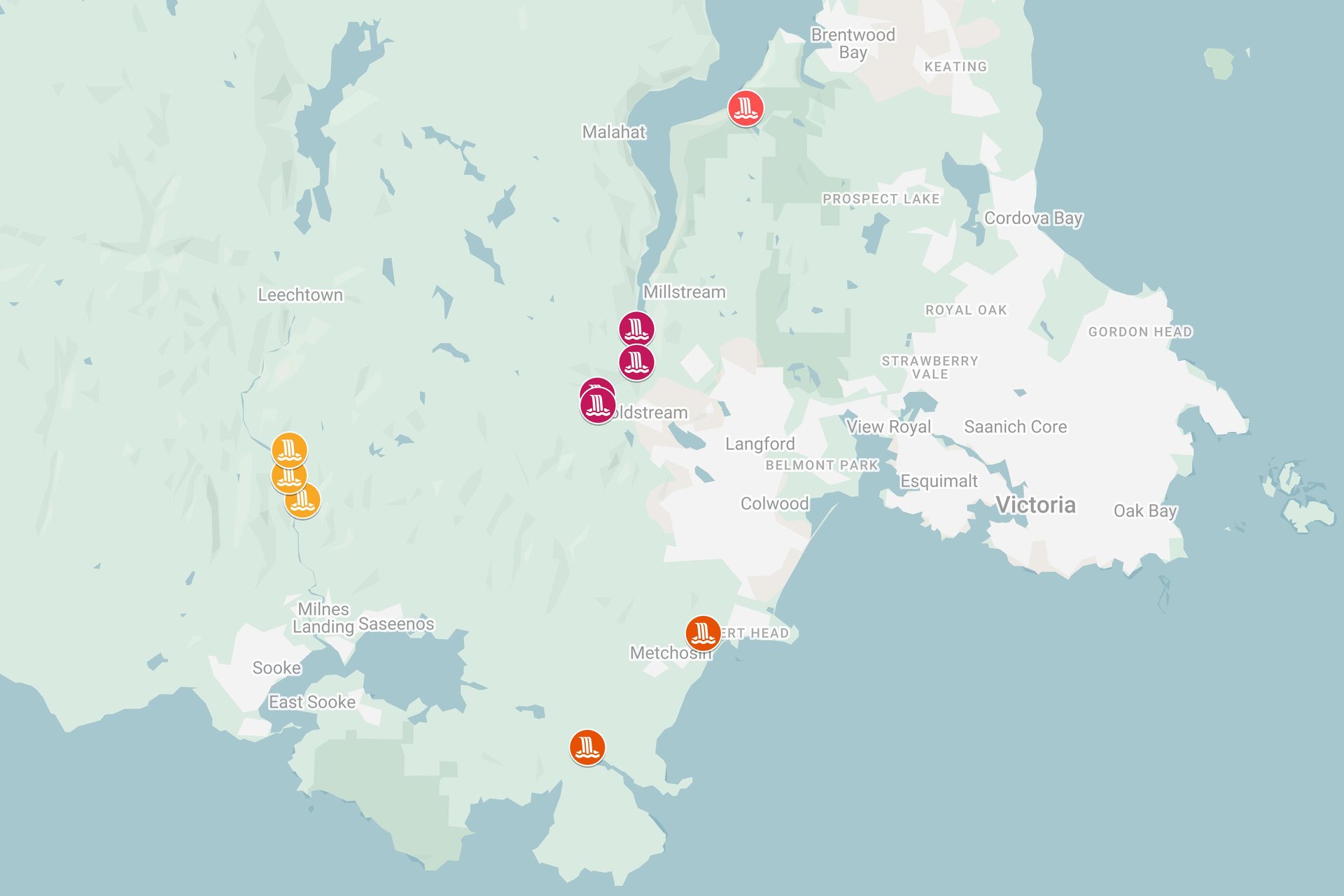
The waterfalls in the Core of the CRD can be divided into two groups.
The first group includes falls near Saanich Inlet:
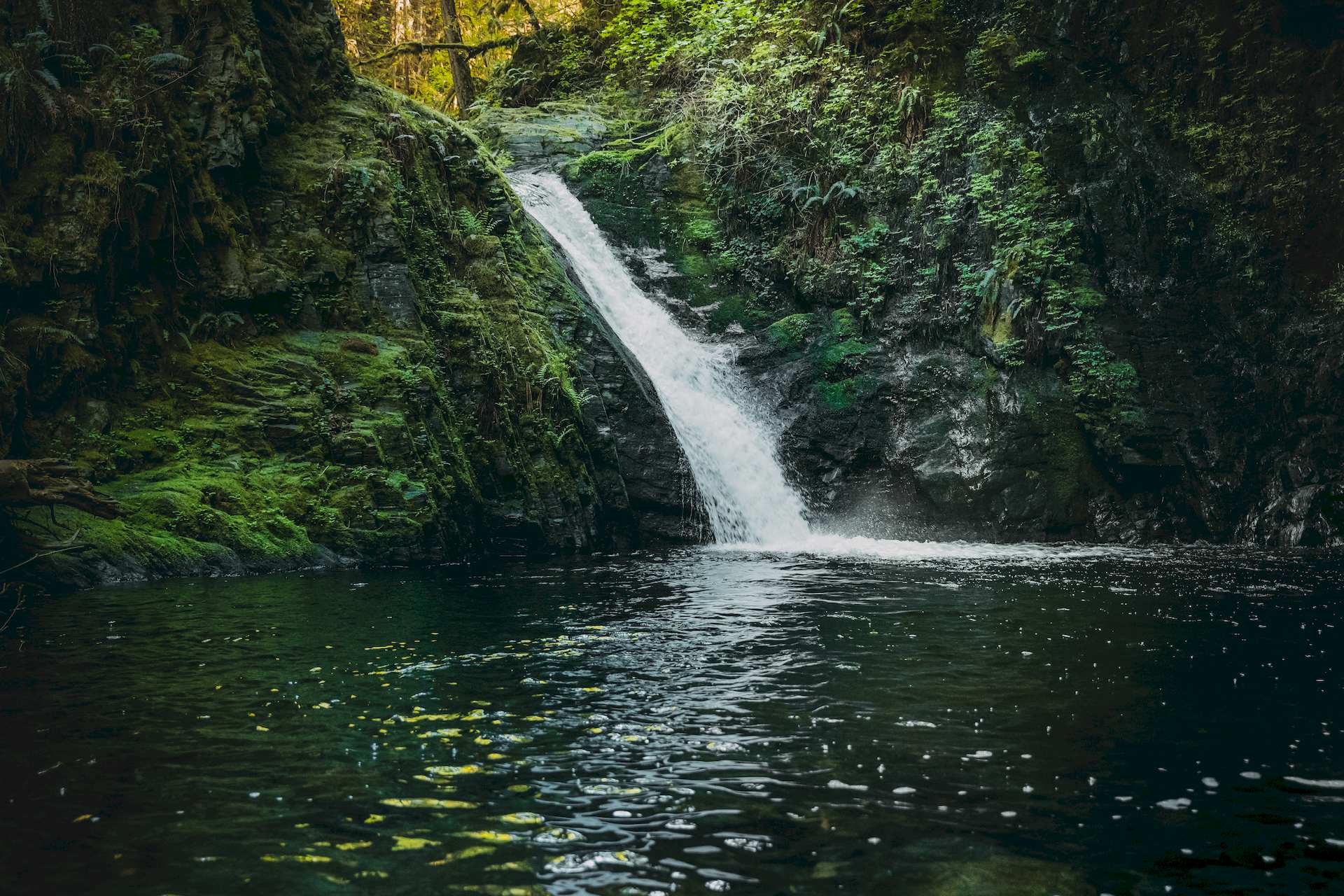
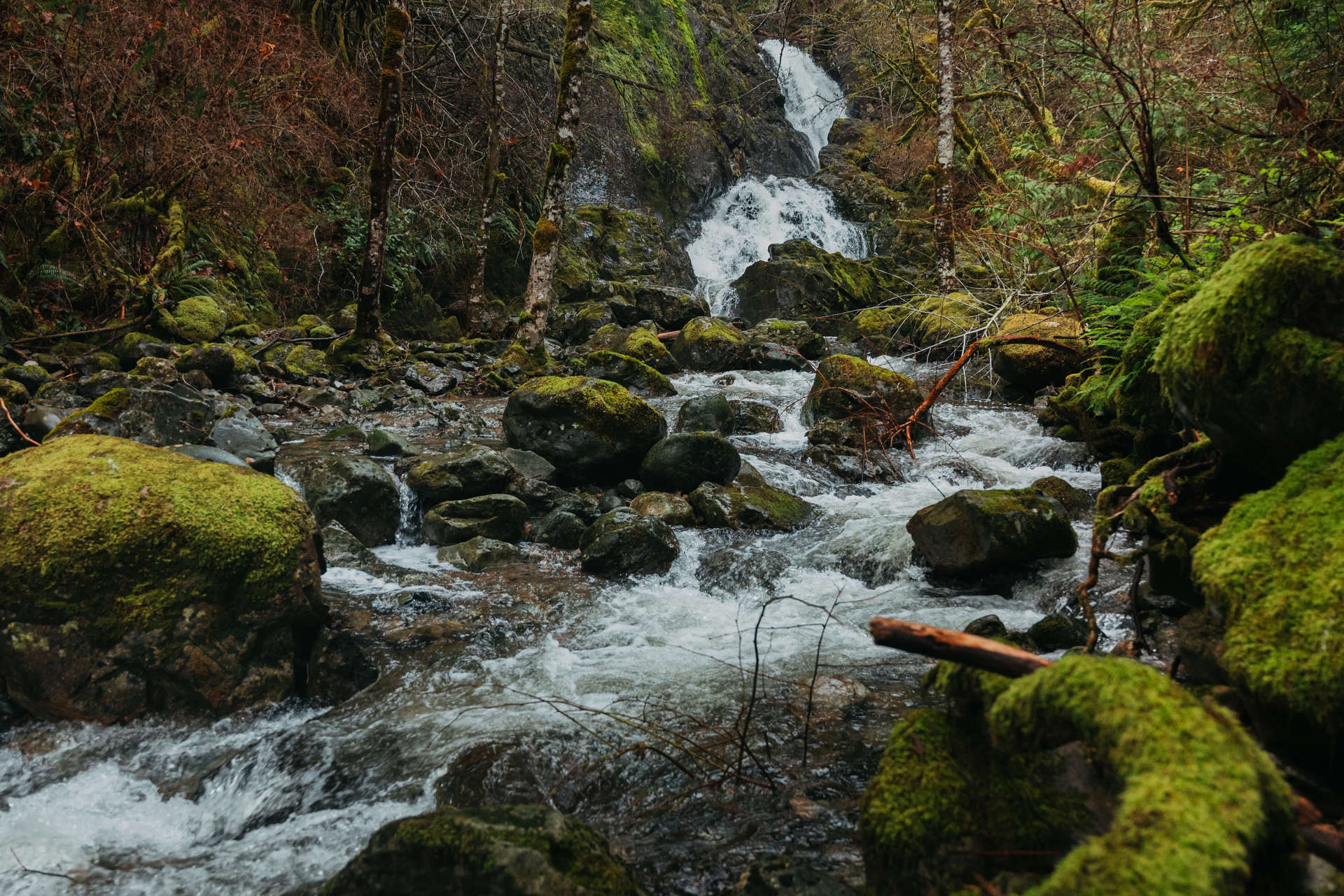
in Gowlland Tod Provincial Park (Highlands): ![]() Cascade Falls,
Cascade Falls,
and in Goldstream Provincial Park (Langford): ![]() Golden Niagara Falls,
Golden Niagara Falls, ![]() Hidden Spring Falls,
Hidden Spring Falls, ![]() Upper Goldstream Falls,
Upper Goldstream Falls, ![]() Waugh Creek Falls.
Waugh Creek Falls.
The second group includes West Shore falls:
in Metchosin: ![]() Sitting Lady Falls,
Sitting Lady Falls, ![]() Pedder Bay Falls,
Pedder Bay Falls,
and in Sooke Potholes: ![]() Todd Creek Falls,
Todd Creek Falls, ![]() Sooke Potholes Falls,
Sooke Potholes Falls, ![]() Mary Vine Creek Falls.
Mary Vine Creek Falls.
Parking: Mount Work Regional Park - Ross Durrance Road Parking Lot.
Start/finish: McKenzie Bight access point (on Ross-Durrance Road).
Distance: Approximately 3.4 kilometers out and back.
Time: Typically takes about 1 to 2 hours to complete the round trip.
Elevation Gain: Around 145 meters.
Difficulty: Suitable for hikers with a basic level of fitness.
Our ranking: ✮ ✮ ✮
Cascade Falls is nestled within the lush forests of Gowlland Tod Provincial Park and is accessible via the Cascade Trail, which begins at the McKenzie Bight access point on Ross-Durrance Road. The trail winds down through dense forest, leading to McKenzie Bight, a scenic beach along Saanich Bay with beautiful views of the opposite shore.
To avoid unnecessary effort when climbing the mountain, it is better to start the route from the end of the trail that is farthest from the parking lot, which is often marked as the exit point.
Parking: The closest parking spot is a small gravel area on the west side of the highway.
Another one is available at the Goldstream Provincial Park day-use area near the Visitor Centre.
Start/finish: The Niagara Falls Trailhead (and the Gold Mine Trail) begins and ends near a small gravel parking area off Malahat Drive, on the west side of the highway.
Distance: 300 m one way.
Time: 15 minutes one way.
Elevation Gain: Minimal.
Difficulty: Easy.
Our ranking: ✮ ✮ ✮ ✮ ✮
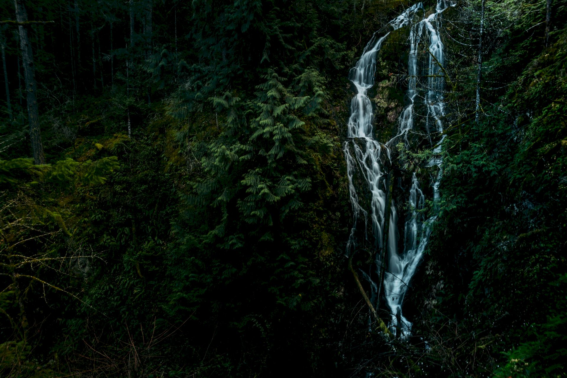
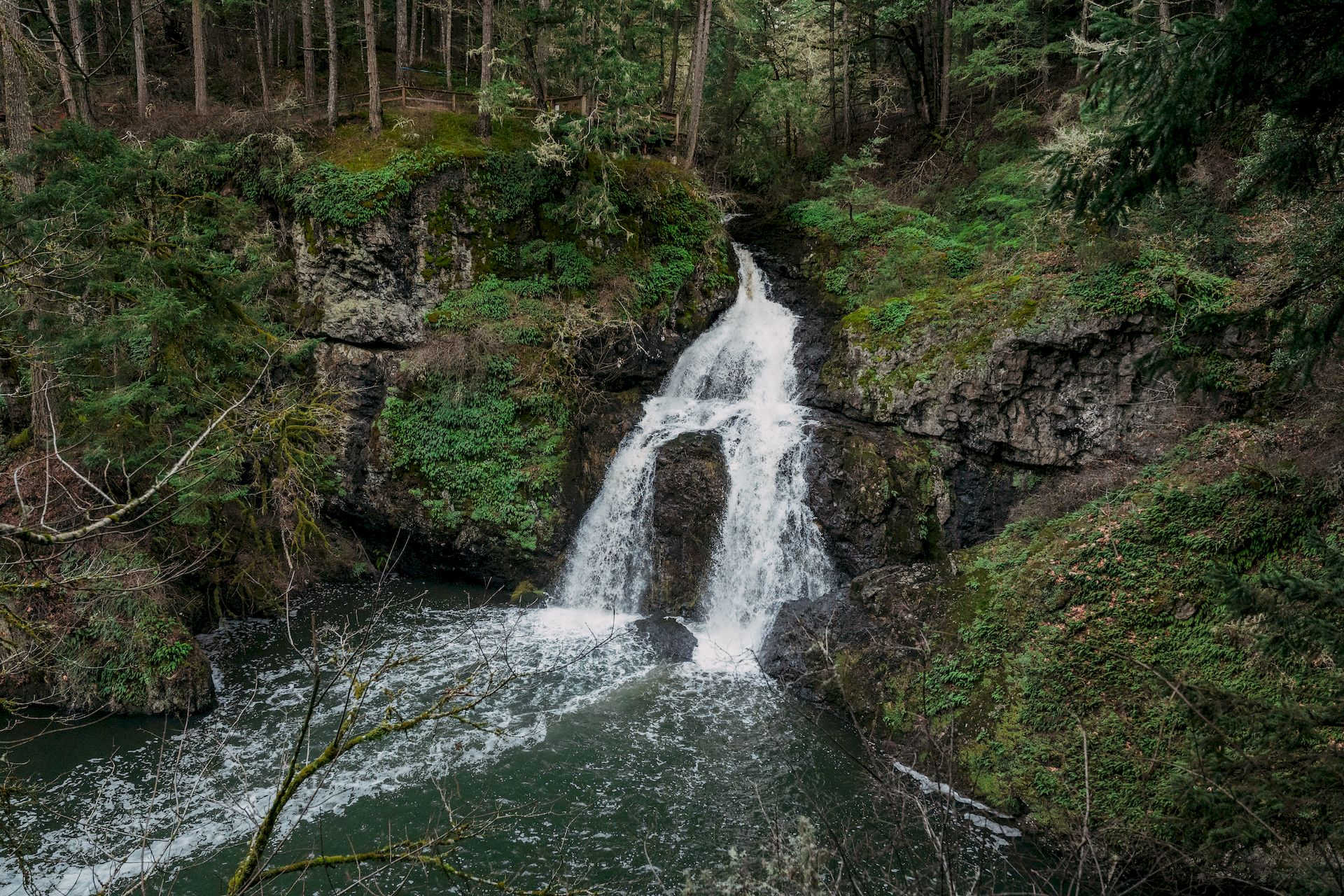
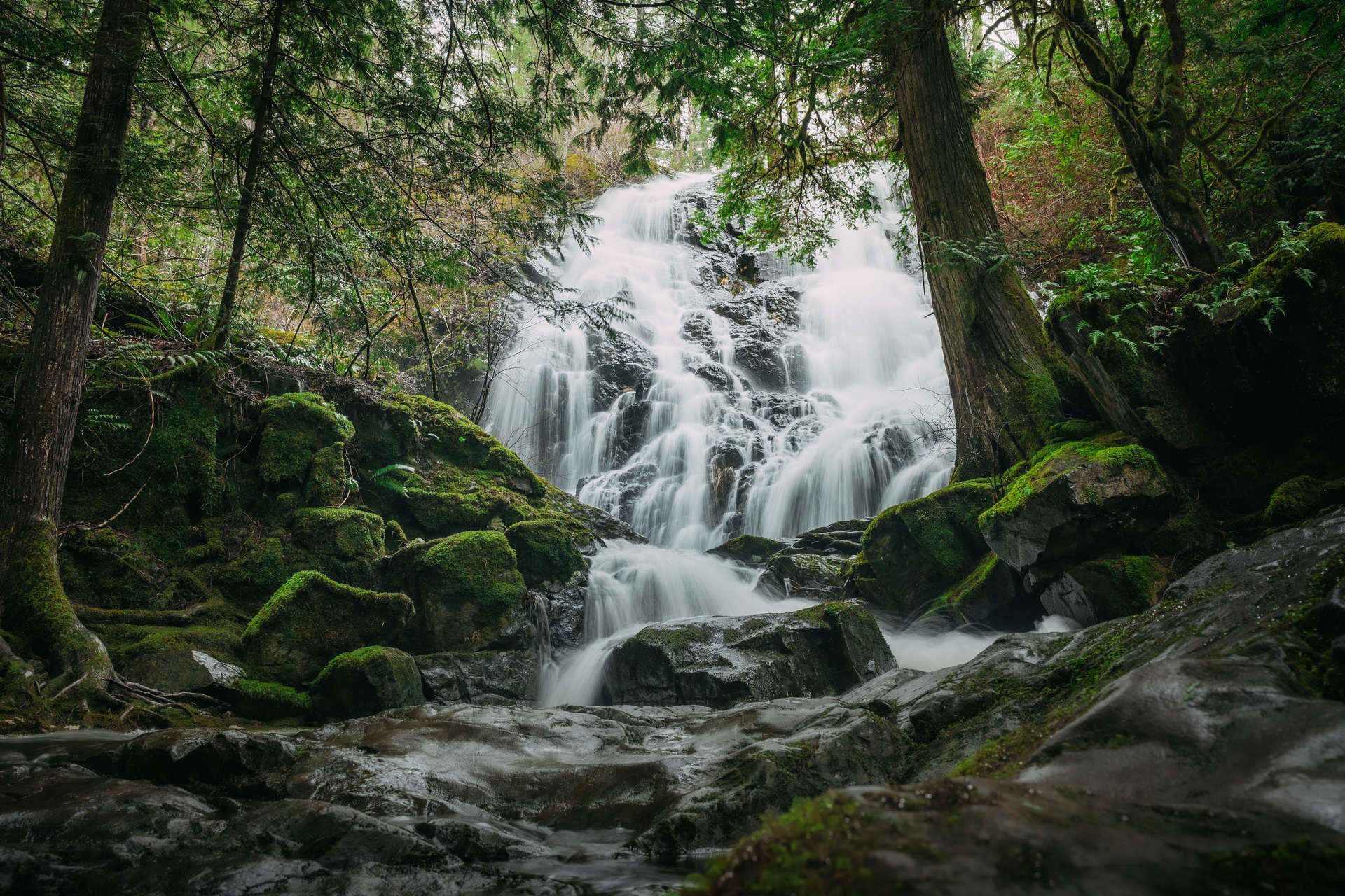
Located in Niagara Canyon, part of Niagara Creek in Goldstream Provincial Park near Langford, Golden Niagara Falls is a stunning and easily accessible waterfall that surprises many visitors with its impressive 47.5-meter (156 ft) drop in a narrow gully.
The hike to Golden Niagara Falls in Goldstream Park is short and accessible, making it ideal for families and casual hikers. The well-trodden trail leads through a lush temperate rainforest, offering beautiful scenery along the way.
One more feature of this hike is the tunnel that passes under the Island Highway. While the terrain is relatively flat, some sections may be slippery after rain, so proper footwear is recommended.
If you are driving from Victoria or Langford, you will need to reach the Shawnigan Lake Drive exit and turn around to access the correct side of the highway. Be attentive — it's easy to miss the small parking area.
Parking: A small, unmarked pull-off accessible only from the southbound lane of the Trans-Canada Highway (on the west side of the highway).
Start/finish: A small, unmarked parking area on the west side of the Trans-Canada Highway, about 1.1 km from the Golden Niagara Falls parking lot.
An alternative option is to walk from the Goldstream Day Use Parking Lot (round trip).
Distance: 300 m one way.
Time: Approximately 5–10 minutes one way.
Elevation Gain: Minimal.
Difficulty: Easy – The trail is short but may be muddy and uneven in places.
Our ranking: ✮ ✮ ✮ ✮
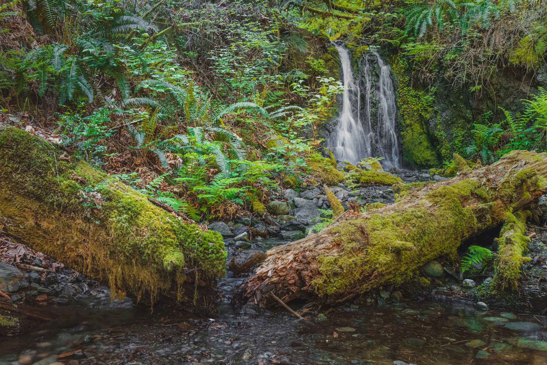
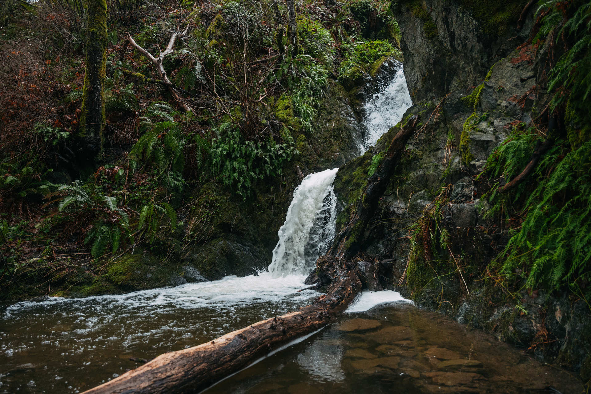
Hidden Spring Falls is a lesser-known tiny waterfall in Goldstream Provincial Park near Langford. Tucked away within the park's lush temperate rainforest, this charming waterfall cascades gently over moss-covered rocks into a tranquil river below. Despite its proximity to the city, Hidden Spring Falls is perfect for those seeking a short, refreshing nature break without travelling far.
As with the Golden Niagara Falls parking area, you will need to make the same turnaround on Malahat Drive to access the correct side of the highway. Be very attentive—it’s easy to miss the unmarked parking spot.
Parking: With frontcountry reservations, parking for one vehicle is included in the regular camping fee for your party (winter camping fee: $13 per party per night).
Start/finish: The junction between Campsites No. 59 and No. 60.
Distance: 300 m one way.
Time: 10 minutes one way.
Elevation Gain: 60 m of stairs.
Difficulty: Easy trail, but with a long flight of stairs.
Our ranking: ✮ ✮ ✮ ✮ ✮
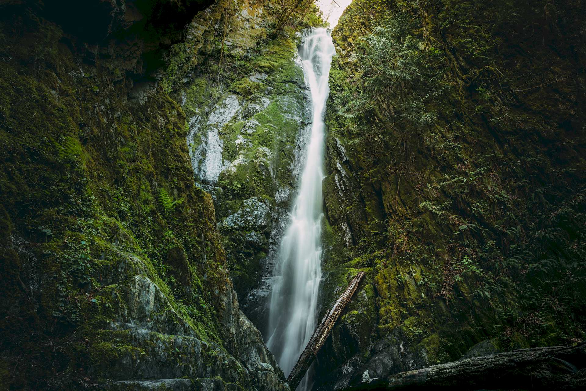
Located in Goldstream Provincial Park near Langford, Upper Goldstream Falls (also commonly called Goldstream Falls) is a popular and easily accessible waterfall that's a favorite among campers and visitors alike. Nestled along the Goldstream Falls Trail, this small but charming waterfall cascades into a shallow, clear pool that's perfect for cooling off in the summer months.
The Upper Goldstream Trail begins between Campsites No. 59 and No. 60. This short, 220-metre path is easy to walk and takes about five minutes. Just before the waterfall, however, there is a long flight of stairs descending into the canyon. They’re a breeze on the way down, but be prepared for a bit of a workout on the climb back up, adding another five minutes to the walk.
Goldstream Provincial Park is open year-round. Check camping and facilities for additional dates. With frontcountry reservations, parking for one vehicle is included in the regular camping fee for your party (winter camping fee: $13 per party per night).
But during the winter or off-season, facilities may be limited, and vehicle access to certain areas of the park may be restricted. In particular, the trail to Niagara Falls may be closed due to washouts. Be sure to check current conditions on the official website before your visit.
Parking: Mount Wells Regional Park – Main Parking Lot.
Start/finish: From the Humpback Reservoir, right next to the parking lot, but if you wish, you can explore a longer section of the 13 km Sooke Hills Wilderness Trail.
Distance: 2 km one way.
Time: 40 m one way.
Elevation Gain: Moderate, one way – 64 m uphill and 59 m downhill.
Difficulty: Relatively easy.
Our ranking: ✮ ✮ ✮
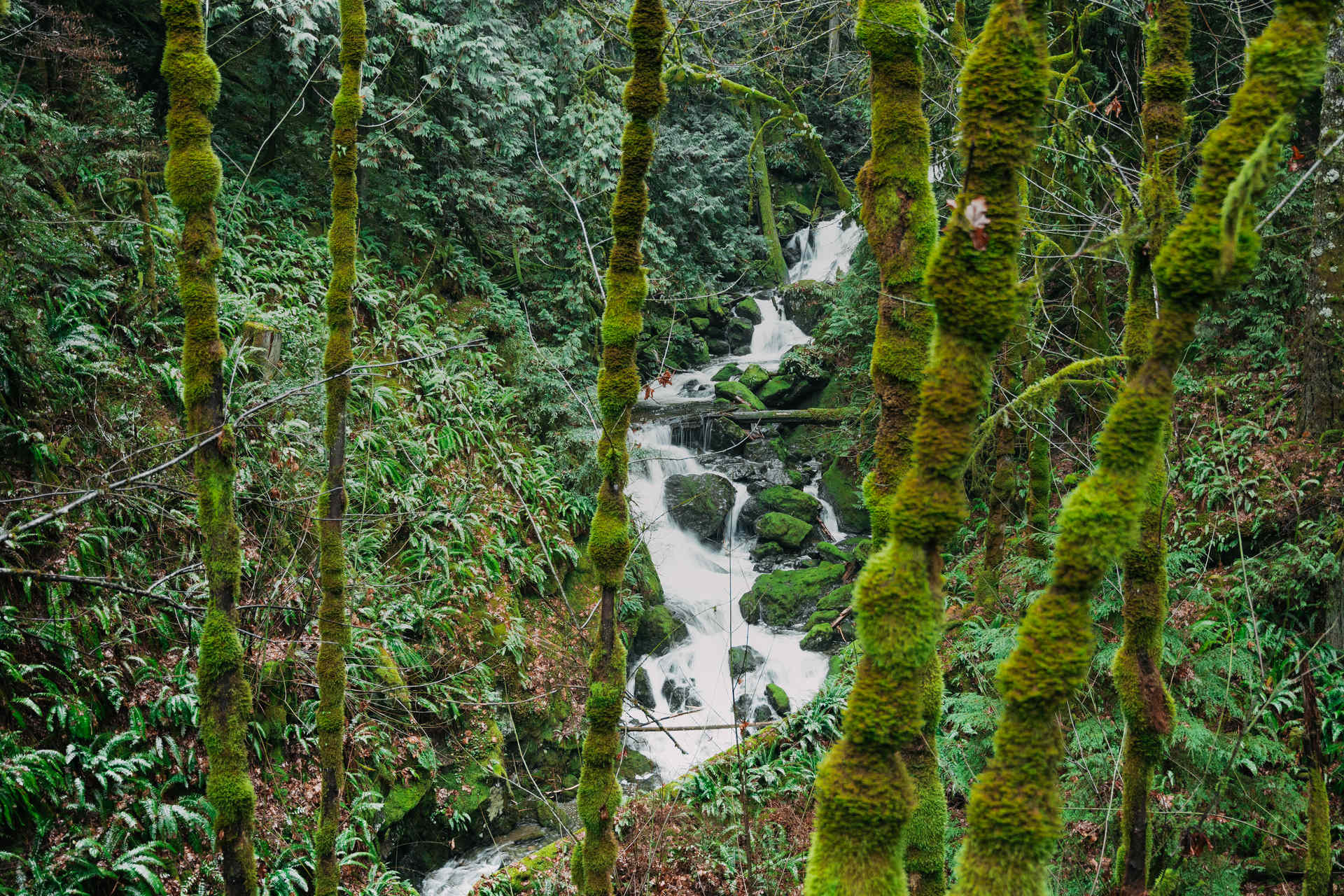
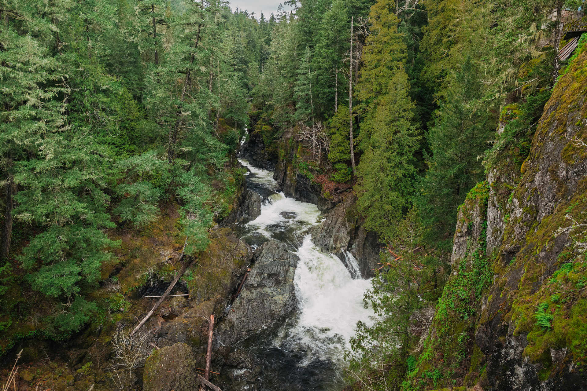
Waugh Creek Falls is tucked away within the Greater Victoria Water Supply Area (GVWSA), near Sooke Hills Wilderness Regional Park on the outskirts of Langford.
Access via Niagara Main Road is restricted and allowed only for employees of the Regional Water Supply Service. Also, a much shorter route (15 minutes instead of 40) starts near Upper Goldstream Falls in Goldstream Provincial Park, following the old Esquimalt & Nanaimo Railway line. However, this route is unofficial and not allowed.
The most common and recommended way to reach the falls is via the Sooke Hills Wilderness Trail, starting from the Humpback Reservoir. The trail continues beyond the park boundary to Wrigglesworth Lake in Wrigglesworth Lake Regional Park. The route follows a wide gravel trail through forested terrain with gentle, rolling hills and is well suited for hiking, walking, and biking. Along the way, the trail passes the Waugh Creek Falls Viewpoint, which offers a clear view of the waterfall. The falls are at their best in winter and spring, when water flow is strongest.
A railway line runs close to the viewpoint.If you continue along the trail for another 0.5 km, it will lead you to a suspension bridge.
Parking: Big Witty’s Lagoon Regional Park parking (4115 Metchosin Rd).
Start/finish: The trail starts right at the parking lot and goes all the way to Witty's Beach.
Distance: 300 m one way.
Time: 10 minutes one way.
Elevation Gain: Minimal.
Difficulty: Easy.
Our ranking: ✮ ✮ ✮
Sitting Lady Falls is located in the forested area of Witty’s Lagoon Regional Park in Metchosin. The falls are accessible via a trail from the main parking lot that follows Bilston Creek, with clear signage along the way.
The waterfall flows year-round. In summer, it is reduced to a gentle stream, while in winter it grows into a powerful, roaring cascade. A wooden viewing platform located along the trail offers an excellent vantage point for photography.
A visit to Sitting Lady Falls can easily be combined with exploring Witty’s Lagoon and Witty’s Beach, thanks to the park’s interconnected network of trails.
Parking: Pedder Bay RV Resort & Marina Parking Lot (Pedder Bay Drive) or Rocky Point Parking Lot (Rocky Point Road).
Start/finish: Just past the Pedder Bay RV Park and/or across the road from Rocky Point Parking Lot.
Distance: 1 km round trip.
Time: 10-15 minutes round trip.
Elevation Gain: Minimal.
Difficulty: Easy.
Our ranking: ✮ ✮ ✮
Pedder Bay Falls is a small waterfall located near Pedder Bay in Metchosin. The falls are on Pedder Bay Creek, hidden in the forest near the Pedder Bay RV Resort & Marina.
The hike to the falls begins just past the RV park and follows a beautiful forested path that weaves through a ravine among mossy trees and dense undergrowth. It’s an easy, nature-filled walk of about 1 km round trip.
The falls can also be accessed from the other side of the Galloping Goose Regional Trail, via the Rocky Point Parking Lot.
Parking: Sooke Potholes Parking Lot 1 (seasonal fees may apply).
Start/finish: Parking Lot 1.
Distance: Very short walk from nearby parking.
Time: 5 minutes round trip.
Elevation Gain: Minimal.
Difficulty: Easy.
Our ranking: ✮ ✮ ✮
Todd Creek Falls is a small waterfall located along Todd Creek in Sooke Potholes Regional Park, near Sooke. The cascades are easily visible from Sooke River Road. They are hard to miss, appearing just a few dozen metres from the bridge over the namesake creek, immediately before Sooke Potholes Regional Park – Parking Lot 1.
The falls are best viewed after rainfall or during wetter seasons, as water flow can drop significantly during summer.
Just upstream is the Todd Creek Trestle, a historic railway bridge now part of the Galloping Goose Regional Trail and a popular spot for walkers and cyclists. The trestle can be reached from the falls via the Todd Creek Connector trail, a forested path that climbs uphill directly from the waterfall and links to the Galloping Goose Trail.
Parking: Sooke Potholes Regional Park - Parking Lot 2.
Start/finish: Parking Lot 2.
Distance: 300 m one way.
Time: 10 minutes one way.
Elevation Gain: The elevation change to the observation deck is minimal, but immediately beyond it is a steep cliff!
Difficulty: Multiple easy to moderate trails leading to viewpoints and river access.
Our ranking: ✮ ✮ ✮ ✮ ✮
Sooke Potholes Provincial Park is managed by BC Parks and covers a section of the area along the Sooke River. Sooke Potholes Regional Park is managed by the Capital Regional District (CRD) and includes additional trails, viewpoints, and parking areas. The two parks are adjacent and often referred to together as Sooke Potholes.
This is a beautiful and unique destination, known for its crystal-clear pools, cascading waterfalls, and smooth rock formations. These deep, naturally carved potholes were shaped over thousands of years by glacial erosion, creating perfect swimming holes surrounded by lush forest. This is a popular destination for hiking, swimming, and sightseeing.
The park is also home to the abandoned Deertrail Resort ruins. The former Deer Trail Resort was originally planned as a luxury getaway with over 200 rooms, pools, spas, and in-house shopping and overlooking the falls. However, the developers ran out of funding, and the project was abandoned before completion. In 2004, the land was acquired as parkland, and the unfinished structures were demolished, leaving behind only the concrete foundation of the primary lodge. The lodge site once offered some of the best views of the falls, but today, the area is fenced off and officially inaccessible. However, the extensive graffiti covering the remains suggests that some visitors continue to ignore the restrictions.
The viewpoint is easy to reach, but immediately beyond it is a drop-off! We strongly do not recommend visiting with children!
Parking: Sooke Potholes Regional Park – Parking Lot 2 (May 1 – Sept 30: fees apply).
Start/finish: Enter near Sooke Potholes Regional Park - Parking Lot 2. Then the trail leads to Pander Lake.
Distance: 500 m one way.
Time: 15 minutes one way.
Elevation Gain: Slight.
Difficulty: Easy to moderate.
Our ranking: ✮ ✮ ✮ ✮ ✮
Mary Vine Creek Falls is located in Sea to Sea Regional Park. The falls are easily accessed via trails from Sooke Potholes Regional Park – Parking Lot 2 and are often combined with a hike to Peden Lake.
The trail follows a forested path with some uneven terrain and is suitable for hiking and walking. Access to the waterfall is relatively easy, though sections near the creek can be slippery after rain.
You can...
If you plan to see all of these gems in just a two-day weekend, it’s worth following the route we recommend. You can also shorten the trip by focusing only on the Langford and Sooke areas, where most of these waterfalls are located. Even this “abridged” version will leave you with a bundle of incredible experiences and memories. And if you manage to do it in a single day — which is entirely possible on the shortened route if you start your hike early in the morning — it will be a memorable day packed with experiences, stunning sights!
Detailed reviews of each of these waterfalls can be found through the links. You can also browse them all in our "Guide", quickly locating the waterfall you want using the filter.
In the "Trails" category, you can easily find this pre-planned and described route here (or follow the link).
And, of course, if you are registered on our site, you can create your own customized route in your profile bookmarks.
Flooding is possible:
Rain also brings flooding — an essential part of the season that visitors should be prepared for. Some trails may be temporarily closed due to flooding, erosion, or safety concerns — always check park advisories before heading out, especially after storms.
Be Careful:
Wet rock can be extremely slippery; keep a safe distance from cliff edges and fast-moving water.
Wear Appropriate Gear:
Wear waterproof boots with good traction, dress in layers, and bring reliable rain protection.
Plan & Play Safe:
If conditions feel unsafe, they probably are. Winter rewards patience, not risk.